
Routes & Day Trips
Hoi An to Deo Le by Motorbike (2026): The Pass Named After Your Tongue
DAY RIDES FROM HOI AN · QUE SON · UPDATED AUGUST 2026
The name tells you what you are in for. Deo Le comes from leo lè lưỡi — “climb until your tongue hangs out” — and locals have a rhyme about it: “Chưa đi chưa biết đèo Le / Đi rồi mới biết đạp lè lưỡi luôn.” It was coined by people pedalling bicycles over the pass, and it stuck. On a modern scooter the climb is easy; what you get for the effort is 7 kilometres of switchbacks over the shoulder of Hon Tau mountain, a cold stream at the summit, and the best free-range chicken in Quang Nam. This guide covers the Hoi An to Deo Le ride: the two routes, what to eat, when not to go, and why almost no foreign visitor has heard of it. You can rent a motorbike in Hoi An the day before and leave early from the Old Town.
Why ride to Deo Le at all
Be honest about what this is. Deo Le is not a famous viewpoint and there is no monument at the top. It is a working mountain road that locals drive to eat lunch and sit in a cold stream. That is precisely the appeal.
It is the anti-Hai Van. The Hai Van Pass has coaches, coffee stops, drone operators and a queue for the summit photo. Deo Le has a handful of chicken restaurants and Vietnamese families on weekends. You will very likely be the only foreigner on the road.
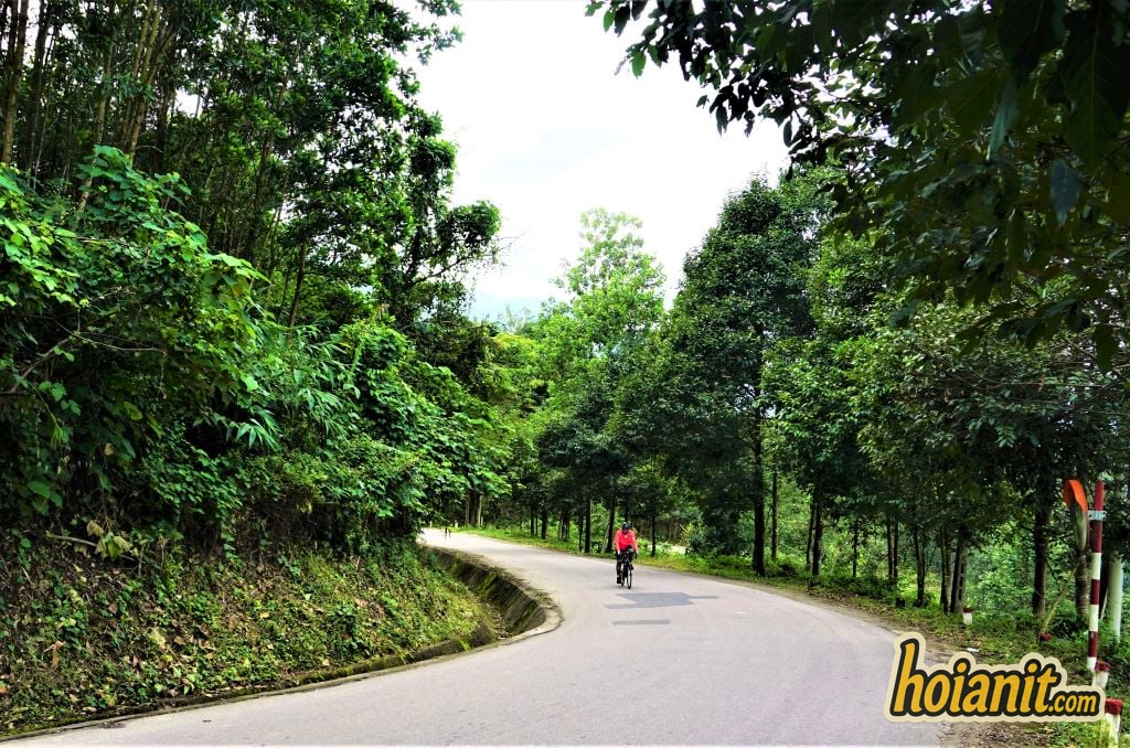
The riding is genuinely good. Seven kilometres of tight switchbacks with almost no traffic, decent tarmac, and forest on both sides. Short enough to enjoy rather than endure.
There is a real reward at the top — a cold mountain stream you can sit in, and a dish that people drive an hour from Da Nang for.
It is a half-day, not an expedition. Leave Hoi An at eight, home by four, having covered about 95 km round trip on flat roads with one pass in the middle.
Where Deo Le is — and the 2025 address change
Deo Le crosses the shoulder of Hon Tau mountain on provincial road DT611, in what was Que Son district, on the boundary of Son Vien and Que Loc communes. It sits roughly 42 km west of Hoi An, about 70 km south-west of Da Nang, and around 60 km north-west of Tam Ky.
One thing every map is now behind on: under Resolution 202/2025/QH15, effective 1 July 2025, Quang Nam province was merged into Da Nang. District-level units were abolished, so “Que Son district, Quang Nam” no longer exists as an administrative address — the area is now organised into communes under Da Nang City. Nothing on the ground moved, and locals still say Que Son. Search Google Maps for “Đèo Le” or “Suối Nước Mát Đèo Le” rather than the province name.
The route from Hoi An, turn by turn
There are two sensible ways to link Hoi An to Deo Le. Both are flat until the pass itself.
- The direct route — via Vinh Dien and Highway 1 (about 42 km). Leave Hoi An west on the Vinh Dien road, join QL1 southbound, and continue to the Huong An junction. Turn west there onto DT611 and follow it around 30 km to the foot of the pass. Fastest, but you spend 20 km on Highway 1 with trucks.
- The quiet route — through the villages (about 55 km). Head south-west from Hoi An on the smaller roads through Duy Xuyen, past the turning to My Son, then cut west to join DT611 nearer the pass. Adds half an hour, avoids most of QL1, and takes you through rice fields and brick-kiln villages. This is the ride worth doing.
Ride out the quiet way, come back the fast way. Morning light is better on the village roads, and after lunch and a swim you will want the shorter run home. If you have already done My Son by motorbike, the first half of the quiet route will feel familiar — the turning for Deo Le comes later.
Fuel: fill up in Hoi An or at Huong An. Stations thin out badly once you are on DT611, and there is nothing on the pass itself.
Riding the pass itself
The climb is about 7 kilometres over the shoulder of Hon Tau, topping out near 500 metres. On a 110cc scooter with one rider it is comfortable; two adults will feel it on the steeper hairpins.
- The corners are tight and blind. This is a local road — trucks carrying timber and construction sand use it, and they cut the corners. Stay right, especially on left-handers.
- Coming down matters more than going up. Scooters have almost no engine braking. Use both brakes in short firm applications rather than dragging the rear the whole way, and stop once to let them cool.
- Watch for gravel and sand washed onto the road surface at corner exits, especially after rain. This is the single most common way people fall here.
- There are pull-offs on the way up with views back over the valley. No formal viewpoint, no railing, no coffee shop — just wide spots on the verge.
- Do not ride it after dark. No lighting, no barriers on some drops, and the corners are unforgiving. Be off the pass by late afternoon.
Suối Nước Mát at the summit
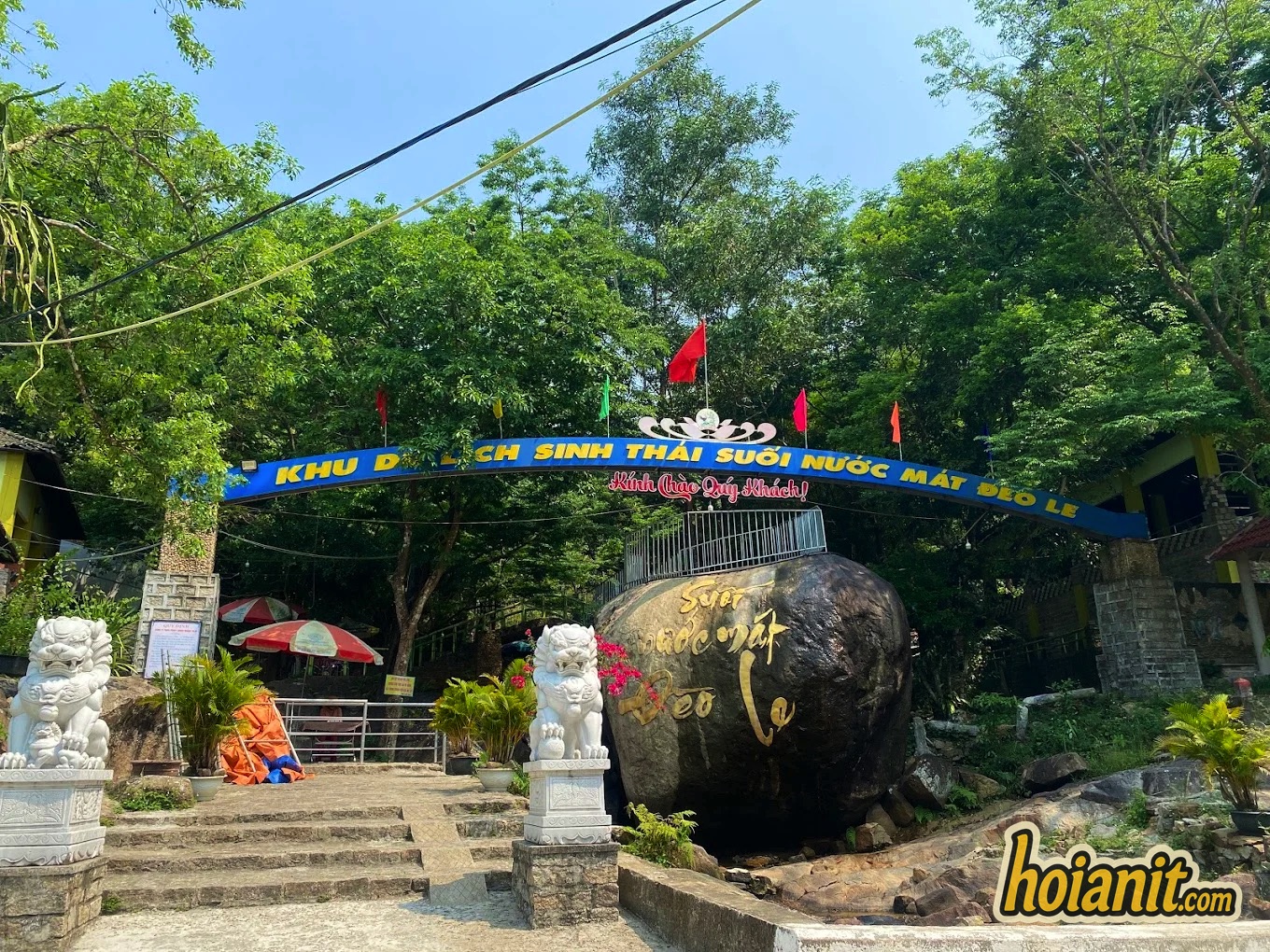
The reason Vietnamese families make the drive: near the top of the pass, Suối Nước Mát — literally “cool water stream” — runs down over boulders, and people simply get in.
What it is: a clear mountain stream with natural rock pools, shaded by forest. Not a resort, not a waterfall park — though a small eco-tourism area has been developed around the lower section.
What to expect: the water is genuinely cold, which is the point when it is 36°C down on the plain. Bring a towel and something to change into. Rocks are slippery; go carefully.
The rhythm of the place: weekdays it is close to empty. Weekends and public holidays it fills with families from Da Nang and Tam Ky who arrive around eleven, eat, swim, and leave by four. If you want it quiet, come midweek or arrive before ten.
Money: the stream itself is free to reach, though the developed area may charge for parking or a deck chair. Small notes only.
Gà tre Đèo Le: what to order
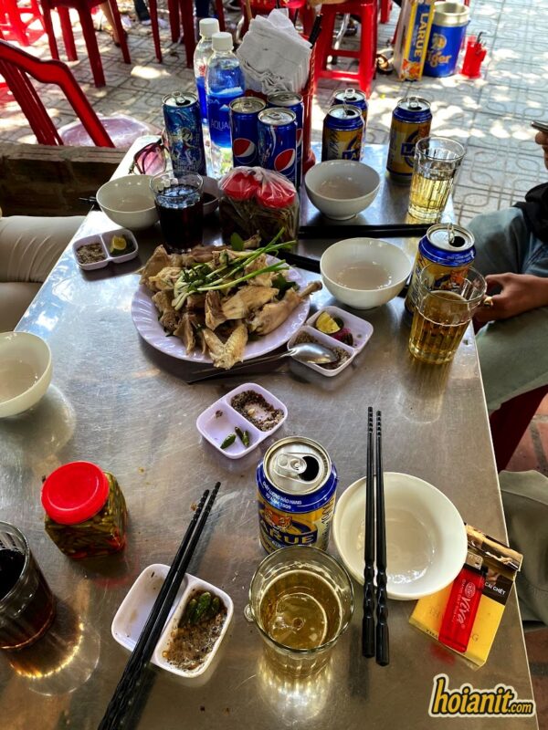
This is not a side note. For a lot of Vietnamese visitors the chicken is the trip, and the restaurants clustered at the top of the pass exist because of it.
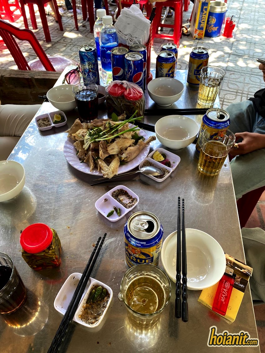
Gà tre is a small free-range breed — bantam-sized, raised loose on the hillsides around Que Son. The meat is firmer and far more flavoured than commercial chicken, and the birds are small enough that one feeds two people.
How it is served: most places do it three ways — hấp (steamed with lime leaf), nướng (grilled over charcoal) and rang muối (salt-roasted). Steamed is the version to order first; it hides nothing.
What comes with it: lime-salt-pepper dipping mix, herbs, and usually a bowl of cháo made from the cooking broth. Order rice separately if you want it.
What to pay: whole birds are priced by weight and vary by restaurant and season. Ask the price before the bird is cooked — standard practice everywhere in Vietnam for anything sold by weight, and the one thing that prevents a surprise at the end.
Timing: restaurants are busiest 11:30–13:00 at weekends. Arriving at 11:00 gets you a table by the stream instead of a plastic stool at the back.
Beyond the pass: hot springs and Nong Son
Most people turn around at the top. If you have the day, the far side is quieter still.
- Tay Vien hot spring — continue west down the far side of the pass and you reach the mineral hot spring at Tay Vien. Hot water after a cold stream, in the same afternoon, which is a strange and good combination.
- Nong Son and the Thu Bon river — the road carries on into the upper Thu Bon valley, the same river that flows past Hoi An. Green, empty, and almost never ridden by visitors.
- Hon Kem Da Dung — further upriver, a gorge where the Thu Bon cuts between cliffs with Cham inscriptions carved into the rock. A serious extra hour each way, and only worth it if you are already committed to a long day.
- Turning it into a loop — experienced riders link Deo Le with My Son on the way back, making a full-day circuit of roughly 130 km. Do this only if you are comfortable riding for six hours.
If you would rather not ride the pass yourself — no licence, no 1968-convention IDP, or simply not confident on switchbacks — guided day trips into the Quang Nam countryside from Hoi An are listed here: day tours from Hoi An. Few sell Deo Le by name, but several cover My Son and the river valleys on the same side of the province.
When to go, and when not to
| Period | Conditions | Verdict |
|---|---|---|
| Feb – Apr | Dry, mild, green after the rains | Best time |
| May – Aug | Hot on the plain, cool at the stream | Go for the water |
| Sep – Dec | Rain and typhoon season, landslide risk | Avoid the pass |
| Weekends | Busy with Vietnamese families | Lively but crowded |
| Midweek | Near empty | What you want |
- Leave early. On the road by 07:30 puts you at the top before the lunch rush and gets you home well before dark.
- Do not ride the pass during or right after heavy rain. This is a forested mountain road in a province that gets serious storms from September to December — landslides and washed-out gravel are real, not theoretical.
- Check the forecast for Que Son, not Hoi An. The coast can be dry while the hills are in cloud.
Practical notes for riders
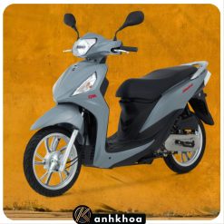
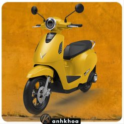
- Bike choice. A 110–125cc automatic is fine solo. Two-up, take a manual — you can hold a lower gear on the climb and get engine braking on the way down. Electric scooters do not have the range for a 95 km round trip with a mountain in it.
- Licence. Anything over 50cc legally needs a licence plus a 1968-convention IDP; 1949 Geneva permits are not valid in Vietnam. See our IDP guide. Riding unlicensed usually voids travel insurance — which matters more on a mountain road than in town.
- Check brakes before you leave Hoi An. Ask the rental shop specifically. Brakes that are fine around town are not automatically fine on a 7 km descent.
- Carry cash in small notes. No card machines anywhere on this route, and changing a 500,000₫ note at a hillside chicken restaurant is a struggle.
- Bring water, a towel and swim clothes. The stream is the payoff; arriving without a towel is the classic mistake.
- Phone signal is patchy on the pass. Download the offline map before you go.
- Tell someone your plan if riding alone. Traffic is light enough that a breakdown can mean a long wait.
- Sun protection. Most of the 40 km approach is unshaded open country.
Khách Tây ít ai biết đèo Le. Đó là lý do nên đi — cả con đèo có khi chỉ mình bạn, xuống suối ngồi rồi ăn con gà tre, chiều về vẫn kịp.
Cần xe khoẻ cho một ngày lên đèo?
Anh Khoa Hội An — 84 Phan Châu Trinh. Xe số và xe ga đời mới, kiểm tra phanh trước mỗi chuyến đường dài, giao xe tận khách sạn miễn phí. Tụi mình chỉ luôn tuyến đường làng đẹp hơn quốc lộ và chấm sẵn chỗ ăn gà tre trên bản đồ.
More Bike Options in Hoi An
E-Bike · No license


No License? No Worries!
Rent a 50cc Bike in Hoi An Today!Over the pass and on. Deo Le is also the homeward leg of a bigger loop: ride DT610 out to Dai Binh village and the Hon Kem Da Dung gorge on the upper Thu Bon — Mekong-style fruit orchards, a boat between 500 m cliffs and a 7th-century Cham inscription — and come back over the pass for the bantam chicken. 117 km in all.
Deo Le is the short hill ride; for a full day in the hills, our guide to Loc Yen ancient village in Tien Phuoc covers the stone-walled village 64 km south-west of Hoi An.
Hoi An to Deo Le — your questions
How far is Deo Le from Hoi An?
About 47 kilometres west of Hoi An, roughly 90 minutes each way by motorbike. The direct route via Highway 1 and the Huong An junction is fastest; a quieter village route through Duy Xuyen adds about 8 kilometres and half an hour but avoids most of the highway traffic.
Why is it called Deo Le?
The name comes from the Vietnamese phrase leo lè lưỡi, meaning to climb until your tongue hangs out. Locals have a rhyme about it: “Chưa đi chưa biết đèo Le, đi rồi mới biết đạp lè lưỡi luôn.” It dates from when people crossed the pass by bicycle, and stuck even though a modern scooter makes the climb easy.
How long and how high is the pass?
The pass runs about 7 kilometres over the shoulder of Hon Tau mountain on provincial road DT611, topping out around 500 metres. It is paved with two lanes and has tight switchbacks, but is short enough to be enjoyable rather than exhausting.
Is there an entrance fee at Deo Le?
No, the pass and the stream are free to reach. The developed eco-tourism area around the lower section of Suoi Nuoc Mat may charge for parking or deck chairs, so carry small notes. Food at the chicken restaurants is priced separately.
What is ga tre Deo Le?
A small free-range bantam chicken raised on the hillsides around Que Son, and the dish most Vietnamese visitors come for. It is usually served steamed with lime leaf, grilled over charcoal or salt-roasted, with a lime, salt and pepper dip and rice porridge made from the broth. Birds are priced by weight, so ask the price before it is cooked.
Is Deo Le still in Quang Nam province?
Not administratively. Under Resolution 202/2025/QH15, effective 1 July 2025, Quang Nam was merged into Da Nang and district-level units were abolished, so the old address of Que Son district, Quang Nam no longer exists. Nothing physical changed and locals still say Que Son. Search maps for Deo Le or Suoi Nuoc Mat Deo Le rather than the province name.
What kind of bike do I need?
A 110 to 125cc automatic scooter is fine for one rider. Two people should take a manual bike so you can hold a lower gear on the climb and use engine braking on the descent. Electric scooters do not have the range for the 95 kilometre round trip with a mountain pass in it.
When should I avoid riding to Deo Le?
September to December, the rain and typhoon season in Quang Nam, when landslides and gravel washed onto the road are a genuine risk. Also avoid riding the pass after dark, as there is no lighting and some drops have no barrier. February to April is the best period, and midweek is far quieter than weekends.
Đọc bản tiếng Việt: Đèo Le — đường đi, suối Nước Mát và gà tre
Cập nhật tháng 8/2026. Số liệu về chiều dài, độ cao đèo và khoảng cách lấy từ nguồn tiếng Việt về Đèo Le và tỉnh lộ 611; thông tin sáp nhập hành chính theo Nghị quyết 202/2025/QH15. Giá gà tre và phí gửi xe thay đổi theo mùa và theo quán — hỏi giá trước khi gọi món. Disclosure: one link on this page is an affiliate link to a booking partner — if you book through it we may earn a small commission at no extra cost to you.








Pick your ride in Hoi AnChọn xe cho chuyến đi Hội An
Scooters, electric bikes and bicycles from one shop in the Old Town — delivered to your hotel, helmets and roadside help included.Xe máy, xe điện và xe đạp — giao tận khách sạn, kèm hai nón bảo hiểm và hỗ trợ dọc đường.
Not sure which one fits? Message us on WhatsApp and we’ll recommend a bike for your plans.
Chưa biết chọn xe nào? Nhắn Zalo 0935 439 306, tụi mình tư vấn theo lịch trình của bạn.