

Routes & Day Trips
Cloud Hunting Near Hoi An: 7 Sea-of-Clouds Spots by Motorbike
Cloud Hunting Near Hoi An: 7 Sea-of-Clouds Spots by Motorbike
Cloud hunting near Hoi An is real, but it rewards timing more than distance. Here are seven dawn rides from the Old Town, measured on Google Maps, with honest odds of actually seeing a sea of clouds.
Most people come to Hoi An for lanterns and the beach, and never look up at the mountains that ring the town. On the right morning those mountains sit above a white, slow-moving ocean of cloud, and you can ride to the edge of it before breakfast. We rent bikes from 84 Phan Chau Trinh and hear the same story every season: some riders come back with the best photo of their trip, others come back with a wet jacket and a view of grey nothing. The difference is almost never the bike or the road. It is the weather the night before, the hour you leave and which mountain you pick.
This guide to cloud hunting near Hoi An rewrites our older list from scratch. Every distance below was re-measured on Google Maps directions from the Old Town, the administrative names are the post-July-2025 ones, and we dropped a spot that was too far and too unreliable to justify. We also tell you plainly where you are more likely to get mist than a true sea of clouds, because a 4:30 alarm deserves honest odds.
Cloud hunting near Hoi An at a glance
Start here if you only have one free morning. The table groups the seven spots by how far you ride and how likely you are to see clouds below you rather than around you. “Odds” is our own rough read from years of customer photos and our own early rides, not a statistic.
| Spot | From Hoi An | Height | What you usually get | Best for |
|---|---|---|---|---|
| Ban Co Peak, Son Tra | 41.6 km · ~1h12 | ~696 m | Cloud drifting over the peninsula, city lights fading out | A first try, close to Da Nang |
| Hai Van Quan | 53.3 km · ~1h31 | 496 m | The summit wrapped in cloud, sometimes a layer over Lang Co | Riders who want the famous road too |
| Ba Na Hills | 42.9 km · ~1h01 | 1,487 m | Riding the cable car through cloud | Families, non-riders after the cable base |
| Ta Lang–Gian Bi, Hoa Bac | 63–66 km · ~1h30 | valley | Mist filling the river valley at dawn | Camping, quiet countryside |
| Le Pass | 42 km · ~1h05 | low pass | Morning mist on the hills | An easy loop with a stream stop |
| My Son | 38.2 km · ~1h05 | valley | Fog around the Cham towers | History plus atmosphere |
| Tak Po, Tra Tap | 147 km · ~3h42 | Ngoc Linh foothills | A true sea of clouds below a ridge | One night in a tent |
For cloud hunting near Hoi An, the rule is simple: if you want a near-guaranteed sea of clouds you have to go high and stay overnight, which means Tak Po. If you want a beautiful sunrise ride that might turn into cloud, Son Tra and Hai Van are the realistic day options. Everything else is mist, which is lovely, but it is a different photo.
How a sea of clouds forms, and how to read the forecast
A “sea of clouds” is simply a flat layer of low cloud or fog sitting under you. It forms when cool, damp air settles into valleys overnight and a warmer layer of air sits on top like a lid. Three conditions stack the odds in your favour:
- Rain the day before. Wet ground and wet forest put moisture into the night air.
- A clear, calm night. Clear skies let the ground cool fast; calm air lets the cold pool collect instead of being stirred away.
- A viewpoint above the cloud base. If the cloud layer sits at 800 m and you stand at 500 m, you are inside it, not above it. That is the most common reason people come back from Hai Van seeing nothing.
In practice: check a weather app the evening before for low cloud or fog in the early morning, light wind and no rain between 4:00 and 7:00. Apps that show cloud layers by height (Windy is a popular one) help you guess whether the cloud will sit below or above your viewpoint. Sunrise around Da Nang ranges from roughly 5:15 in June to about 6:15 in January, and the best cloud usually lasts less than an hour after first light. Once the sun warms the valley, the layer breaks up.
A sea of clouds is a forecast you read the night before, not a place you ride to and hope.
Seasonally, for cloud hunting near Hoi An the cool months from November to March bring the most damp, misty mornings to the mountains around Hoi An and Da Nang. The trade-off is rain: the same season brings wet roads and the occasional washed-out morning, so plan a back-up day. Our separate Hai Van Pass weather tips go deeper on reading the pass month by month.
Son Tra: Ban Co Peak
Ban Co (Chessboard) Peak is the high point of the Son Tra peninsula, about 696 m above the sea that surrounds it on three sides. From Hoi An it is 41.6 km and about 1h12 on Google Maps via Lac Long Quan, at coordinates 16.1189, 108.2720. Local travel writers point to January and February as the best months for cloud here, and to the hour from about 5:30 to 7:00 as the window.

Da Nang closed the road from the DRT relay station up to Ban Co Peak to automatic scooters after a run of serious crashes on the steep descents. Semi-automatic and manual bikes are allowed. If you rent a scooter for the beaches and Linh Ung Pagoda, you will be turned back before the peak. Tell us the night before and we will put you on a semi-automatic instead.
The reason for the ban is real: the road climbs through tight hairpins with long, steep descents, and scooter brakes overheat when riders brake all the way down. On a semi-automatic you can hold a low gear and let the engine slow the bike. Bring a jacket; at 5:30 on the peak in January it is noticeably colder than the beach. For the rest of the peninsula, including the Lady Buddha and the langur viewpoints, see our Son Tra and Lady Buddha guide from Hoi An.
Hai Van Pass and Hai Van Quan
The name says it: Hai Van means “sea clouds”, because the summit spends so much of the year inside cloud. The old gate of Hai Van Quan sits at 496 m on the crest of the Bach Ma–Hai Van ridge. From the Old Town it is 53.3 km and about 1h31 via the DT607 coast road (66 km if you let Maps send you onto the expressway, which motorbikes cannot use anyway). Coordinates: 16.1877, 108.1313.

That last point matters for cloud hunting. Because the gate is only 496 m high, the cloud on a typical morning is around you rather than below you. The trick is to ride up early, check the summit, and if it is socked in, drop back down a few hairpins on the Da Nang side and look across: you will often see the cloud pouring over the ridge you just left.
Hai Van Quan started charging an entrance fee of 70,000₫ per person from 2 June 2026, the same for Vietnamese and foreign visitors. The fee is collected by the Hue Monuments Conservation Centre: the restored site is managed in three-year turns between Hue and Da Nang, and Hue holds the first term, 2026 to 2028. You can still ride the pass and stop at the viewpoints without a ticket; the fee is for entering the fortress itself. (The Saigon Times)
For the full ride, fuel stops and what is on each side of the pass, read our Hai Van Pass by motorbike guide. Remember motorbikes are not allowed through the Hai Van tunnel; you have to ride over the top, which, for this trip, is the point.
Ba Na Hills
Ba Na is the highest place on this list, with the summit of Nui Chua at 1,487 m, and on many mornings the cable car glides straight through a cloud layer. The base station is 42.9 km from Hoi An, about 1h01 on Google Maps via QL1A, at 16.0266, 108.0328. Since July 2025 the area sits in the new Ba Na commune, formed from Hoa Ninh and Hoa Nhon.
The honest catch: the cable car opens around 8:00. By then the dawn cloud has often lifted, so you are more likely to ride through cloud in the cabin than to stand above a sea of it at sunrise. The only way to be on the summit at first light is to stay overnight in the hotel at the top. If you do not mind that, Ba Na is the most comfortable cloud hunt of the lot, and the ticket and cable car are a known quantity.
We do not sell Ba Na tickets ourselves. If you want to book ahead, you can compare Ba Na Hills tickets and tours on GetYourGuide; sort by reviews rather than price. Our Hoi An to Ba Na Hills by motorbike guide covers the ride, parking at the base and which route to take.
Hoa Bac: Ta Lang–Gian Bi valley
Hoa Bac is the green, river-cut countryside west of Da Nang, home to the Co Tu villages of Ta Lang and Gian Bi and a growing number of campsites. Since July 2025 it is no longer a commune of its own: Hoa Bac was merged with Hoa Hiep Bac and Hoa Hiep Nam into the new Hai Van ward, so Google Maps now labels the community tourism centre at Ta Lang–Gian Bi as “Hai Van, Da Nang”. Do not let that confuse you with the pass; they are neighbours, not the same place.

From the Old Town it is 63–66 km and about 1h30, depending on whether you go through Da Nang or along DT601 (coordinates 16.1205, 107.9923). The valley is low, so what you get here is mist lying in the river bends rather than a sea of clouds seen from a summit. It is quiet, it is beautiful, and it is the best choice on this list if you want to camp: many riders pitch a tent or book a glamping site, wake up inside the mist and watch it burn off over breakfast.
Le Pass and My Son: mist, not a sea
These two are on the list because they are close, easy and genuinely atmospheric at dawn, not because they produce a sea of clouds. Set your expectations accordingly.
Le Pass (Deo Le) is 42 km from Hoi An, about 1h05 via DT611, ending at the Nuoc Mat stream at 15.6887, 108.1628. It is a low pass, so on damp mornings the surrounding hills come wrapped in mist, and the road is quiet enough to stop wherever the light is good. Our Hoi An to Le Pass guide covers the stream, the food and the road.
My Son is the closest spot at 38.2 km, about 1h05 via DT610 (15.7688, 108.1193). The Cham towers sit in a bowl of hills, and on cool mornings fog lies around them before the tour buses arrive. Go at opening time and check the posted hours at the gate.

For the ride itself, read My Son by motorbike from Hoi An; for the history of the towers, our My Son Sanctuary guide.
Tak Po: the real sea of clouds
If you want the classic photo of a tent above an ocean of white, this is where you go. Tak Po (also written Tăk Pổ or Tắk Pổ) is an isolated hill on the slopes of the Ngoc Linh range, in the old Nam Tra My district. After the 2025 reorganisation it belongs to the new Tra Tap commune, formed from Tra Cang and Tra Tap, and still inside Da Nang city on today’s map.
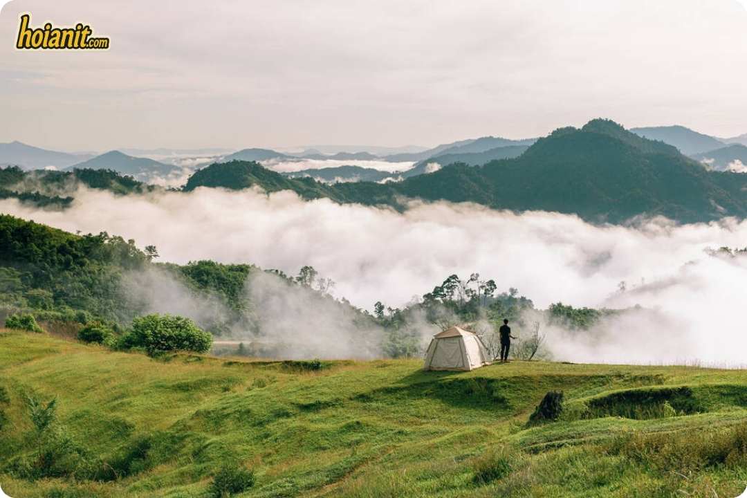
Google Maps puts it at 147 km and about 3h42 from Hoi An via QL40B (coordinates 15.1539, 108.0716). That makes it an overnight trip: ride up in the afternoon, camp, and be out of the tent before 5:30. Vietnam’s national tourism site describes Tak Po as about 9 km from the centre of Nam Tra My and notes that the road to the once-remote Tak Po school has since been upgraded (Vietnam National Authority of Tourism). Travellers who have camped there report that the final road is manageable and a motorbike can reach the top, but there are few services, so bring your own tent, food and water.
This is mountain riding with long climbs and descents, far from help. Fill up in town before the last stretch, carry rain gear, and do not ride the mountain road in the dark. Check the forecast for the night you camp, not only for the drive. Our roadside line, +84 766 766 087, works 24/7, but at this distance help takes hours, not minutes.
We removed Long Mon Pass in Quang Ngai from the old version of this list. It is beautiful in its own right, but it is well over three hours away and its morning fog is less reliable than Tak Po, which is the better use of a long ride.
Which bike to rent for cloud hunting near Hoi An, and the dawn checklist
The bike decision is mostly made for you by the destination:
- Son Tra, Ban Co Peak: semi-automatic or manual only. Automatic scooters are turned back on the upper road.
- Hai Van, Ba Na base, Le Pass, My Son, Hoa Bac: a well-maintained automatic scooter is fine for most riders. A semi-automatic gives you engine braking on the descents if you are comfortable shifting.
- Tak Po: a bike with some power and good brakes, ridden by someone already comfortable on mountain roads. This is not a first ride.
- Electric scooters: great around town, but we do not recommend them for these rides. Long climbs drain the battery and there is nowhere to charge at 5:00 on a mountain.

Our delivery runs from 07:00 to 21:00 every day, so for a 4:30 departure take the bike the evening before. Delivery to your hotel in Hoi An costs from 30,000₫, or collect it at 84 Phan Chau Trinh. Petrol bikes come with one litre in the tank; the deposit is 2,000,000₫, or a copy or photo of your passport. Browse the fleet on our motorbike rental in Hoi An page.
The dawn checklist
- Check the forecast at 21:00 the night before: low cloud or fog at dawn, light wind, no rain from 4:00 to 7:00.
- Work back from sunrise: travel time plus 20 minutes on top for the clouds before first light.
- Fill the tank the evening before. Some petrol stations on the way are still closed at 4:30.
- A warm layer, a rain jacket, gloves and a headlamp. Summits are several degrees colder than the beach, and wind chill on the bike makes it feel colder still.
- Clean your visor and turn your headlight on. Dawn mist on a mountain road cuts visibility to a few metres.
- Share your route with someone, and save our roadside number +84 766 766 087.
Want a bike ready for a 4:30 start?
Message us the day before with where you are going and we will match the bike to the road: a semi-automatic for Son Tra, something stronger for Tak Po. Delivery to your Hoi An hotel from 30,000₫ (07:00–21:00), helmets and raincoats included, 300+ bikes to choose from.
WhatsApp +84 935 206 306See bikes & prices
Zalo 0935 439 306 · Roadside 24/7: +84 766 766 087 · 84 Phan Chau Trinh, Hoi An
FAQ
What is the best time of year for cloud hunting near Hoi An?
The cool, damp months from November to March give the most misty mornings in the mountains around Hoi An and Da Nang, with January and February often cited as the best months on Son Tra. The same season brings rain, so keep a spare day and check the forecast the night before.
What time should I leave Hoi An to see the clouds at sunrise?
Work back from sunrise, which in Da Nang ranges from about 5:15 in June to about 6:15 in January. Son Tra is about 1h12 away and Hai Van Quan about 1h31, so most riders leave between 4:00 and 4:30 to arrive before first light.
Can I ride an automatic scooter to Ban Co Peak on Son Tra?
No. The upper road from the DRT relay station to Ban Co Peak is closed to automatic scooters. Semi-automatic and manual bikes are allowed. You can still ride a scooter to the lower parts of the peninsula, such as Linh Ung Pagoda and the beaches.
Can I see a sea of clouds at Ba Na Hills at sunrise?
Only if you stay overnight at the top. The cable car opens around 8:00, when the dawn cloud has often lifted, so day visitors usually ride through cloud in the cabin rather than watching a sea of clouds from the summit.
How far is Tak Po from Hoi An, and do I need to stay overnight?
Google Maps measures 147 km and about 3 hours 42 minutes via QL40B. Because the clouds are best before 6:00, you need to camp overnight. There are few services, so bring your own tent, food and water.
Is there an entrance fee at Hai Van Pass?
Riding the pass and stopping at the roadside viewpoints is free. Entering the Hai Van Quan fortress at the summit costs 70,000₫ per person since 2 June 2026, the same price for Vietnamese and foreign visitors.
Can you deliver a motorbike for a very early start?
Our delivery hours are 07:00 to 21:00, so for a pre-dawn ride we deliver the bike the evening before. Delivery to hotels in Hoi An costs from 30,000₫, or you can collect it at 84 Phan Chau Trinh.
Distances and times were measured on Google Maps directions from Hoi An Old Town (15.8801, 108.3380) to the coordinates given for each spot when this guide was updated in October 2026; your own route and stops will change them. Administrative names follow the 1 July 2025 reorganisation of Da Nang and the former Quang Nam province. Ticket prices and road rules change, so check locally before you ride. This page contains an affiliate link to GetYourGuide; if you book through it we may earn a small commission at no extra cost to you. We do not sell Ba Na Hills tickets or tours ourselves.


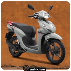
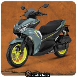
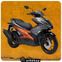
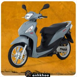




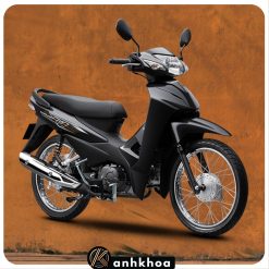




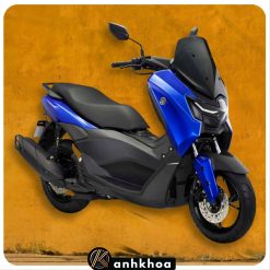



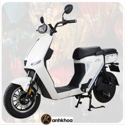
Bikes Rental










Pick your ride in Hoi AnChọn xe cho chuyến đi Hội An
Scooters, electric bikes and bicycles from one shop in the Old Town — delivered to your hotel, helmets and roadside help included.Xe máy, xe điện và xe đạp — giao tận khách sạn, kèm hai nón bảo hiểm và hỗ trợ dọc đường.
Not sure which one fits? Message us on WhatsApp and we’ll recommend a bike for your plans.
Chưa biết chọn xe nào? Nhắn Zalo 0935 439 306, tụi mình tư vấn theo lịch trình của bạn.